Hiking is one of the most popular outdoor activities for both visitors and locals around Missoula. The options feel seemingly endless and the accessibility can't be beat, with 60,000 acres of surrounding wilderness and countless trail systems snaking throughout the city. Missoula trails scored not one, but two spots on a recent list of the 9 Best Hikes to Experience in Montana, and there's a whole lot more where that came from.
Outdoor recreation is built into the culture of Missoula, so you're bound to run into a trail no matter which direction you head. And when you're done trekking at the end of the day, a cold beer and delicious food is always waiting back in town. What more could you ask for? Here are some top trails to explore in and around Missoula.

These are your go-to trails in Missoula. The trails you can hit for a quick morning jog or evening stroll, or spend a whole afternoon exploring. All of these trails can be accessed within a 15 minute drive from Missoula or less, and you will probably pass some friendly faces during your trek.
Waterworks Hill offers a dog-friendly, moderately trafficked trail that erupts with wildflowers in the spring and offers killer views of Missoula.
Distance: 3.5 miles
Elevation Gain: 708 feet
Trail Type: Out & Back
Directions
Mount Jumbo has multiple trails snaking along the hill, though the most popular route leads to the giant "L" we see from town. Mount Jumbo is known for its burst of color as the wildflowers take over each spring, and ambitious hikers can continue past the "L" for more elevation gain and even better views from the top of Mount Jumbo.
Distance: 1.7 miles
Elevation Gain: 623 feet
Trail Type: Out & Back
Directions
One of Missoula's most popular trails, this hike packs a punch with quick elevation gain up a set of switchbacks. But trust us, the view from the "M" is worth the trek.
Distance: 1.2 miles
Elevation Gain: 643 feet
Trail Type: Out & Back
Directions
Pattee Canyon offers a number of routes, so hikers can choose to make it a quick trip or hike as much as 8 miles out & back. The trails are nestled in a forested area within 15 minutes of Missoula, making them a nice change of scenery if you're used to the wide-open views from spots like Mount Jumbo.
Distance: Up to 8 miles
Elevation Gain: Up to 1,578 feet
Trail Type: Out & Back
Directions
Rattlesnake National Recreation Area has a number of options when it comes to hiking difficulty and length, with some of the more challenging routes being multi-day excursions! Dogs are only allowed on certain trails, so be aware of signage at the trailhead.
Distance: Up to 33.9 miles
Elevation Gain: Up to 4,389 feet
Trail Type: Out & Back, Loop
Directions
Similar to the Rattlesnake National Recreation Area, Blue Mountain is chock full of criss-crossing trails, allowing folks to choose their own adventure as they hike, bike and ride horseback. Blue Mountain is also a go-to for dog owners, as the area allows off-leash fun for friendly dogs.
Distance: 41+ miles of trail
Elevation Gain: N/A
Trail Type: Out & Back, Loop
Directions
This nature-filled loop is perfect for a mellow hike, bike or run right outside of Missoula. Minimal elevation gain makes it an easy trek, while the Bitterroot River offers tranquil views along the way.
Distance: 1.7 miles
Elevation Gain: 9 feet
Trail Type: Loop
Directions
The Kim Williams Trail is great for all skill levels, offering nearly 10 miles of flat, heavily-trafficked trail meandering along the Clark Fork River.
Distance: Up to 9.8 miles
Elevation Gain: 209 feet
Trail Type: Out & Back
Directions
While these trails aren't steps from your own front door, they are well worth the drive from Missoula. Plus, you get to enjoy a scenic drive through Western Montana on the way—because let's face it, every drive in Montana is a scenic one. Pay extra attention to the distance and elevation gain, as some of these will require an extra early start and lots of snacks and water!
You haven't seen the Bitterroot Valley like this before. Trek this out & back trail for outstanding views that sweep across the entire valley, and watch for wildflowers if you make the trip in spring or early summer.
Distance: 2.8 miles
Elevation Gain: 531 feet
Trail Type: Out & Back
Directions
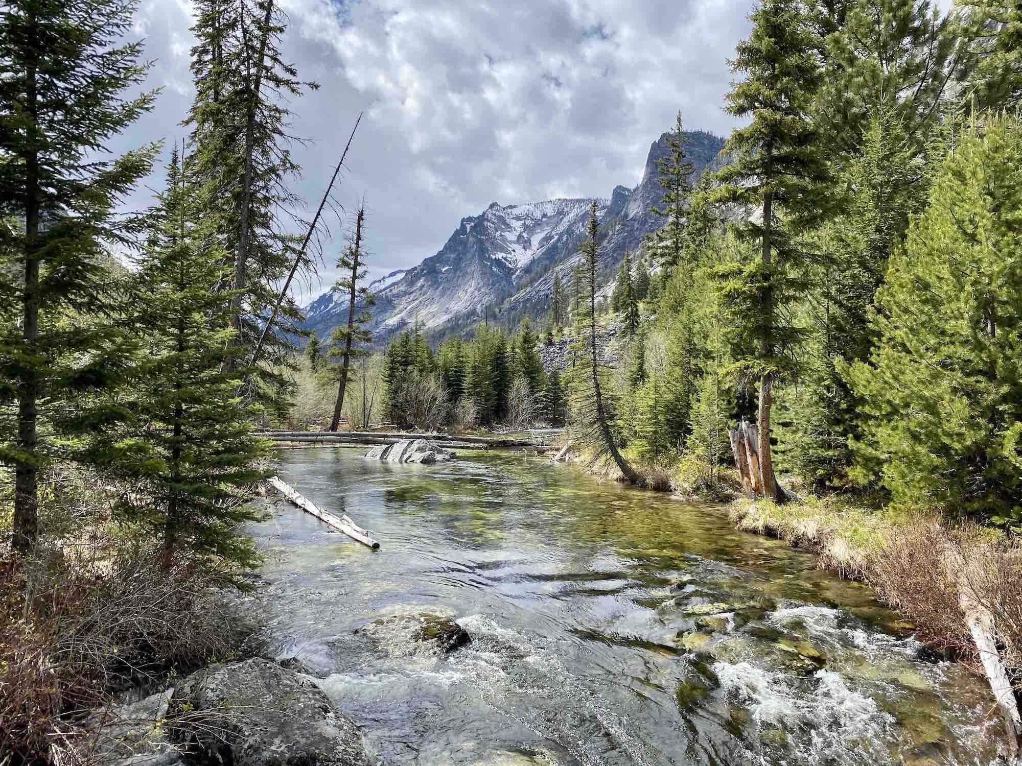
Take in the views along the Blodgett Canyon Overlook trail, or trek through the canyon below and follow the creek until you reach a roaring waterfall.
Distance: 8.5 miles
Elevation Gain: 938 feet
Trail Type: Out & Back
Directions
The trail is rated moderate to difficult, as it gains significant elevation and covers some more difficult terrain. But if you're up for the challenge you'll be rewarded with crystal clear lake water and epic views along the way.
Distance: 8.2 miles
Elevation Gain: 2,536 feet
Trail Type: Out & Back
Directions
Holland Lake is a great spot for camping or a nature-filled day trip, but that's not all—hike just over 3 miles from the lakeside trailhead for a beautiful waterfall.
Distance: 3.3 miles
Elevation Gain: 485 feet
Trail Type: Out & Back
Directions
Take a day trip near Seeley Lake and explore trails such as the Morrell Falls route, which features a small lake and beautiful falls at the end of a moderately trafficked trail.
Distance: 5.4 miles
Elevation Gain: 462 feet
Trail Type: Out & Back
Directions
If you're giving dry a try this month, Missoula has plenty of spots for mocktails. Check out some of our favorites
Follow Us