Land Agency
University of Montana
406.243.2196
City of Missoula
406.552.6000
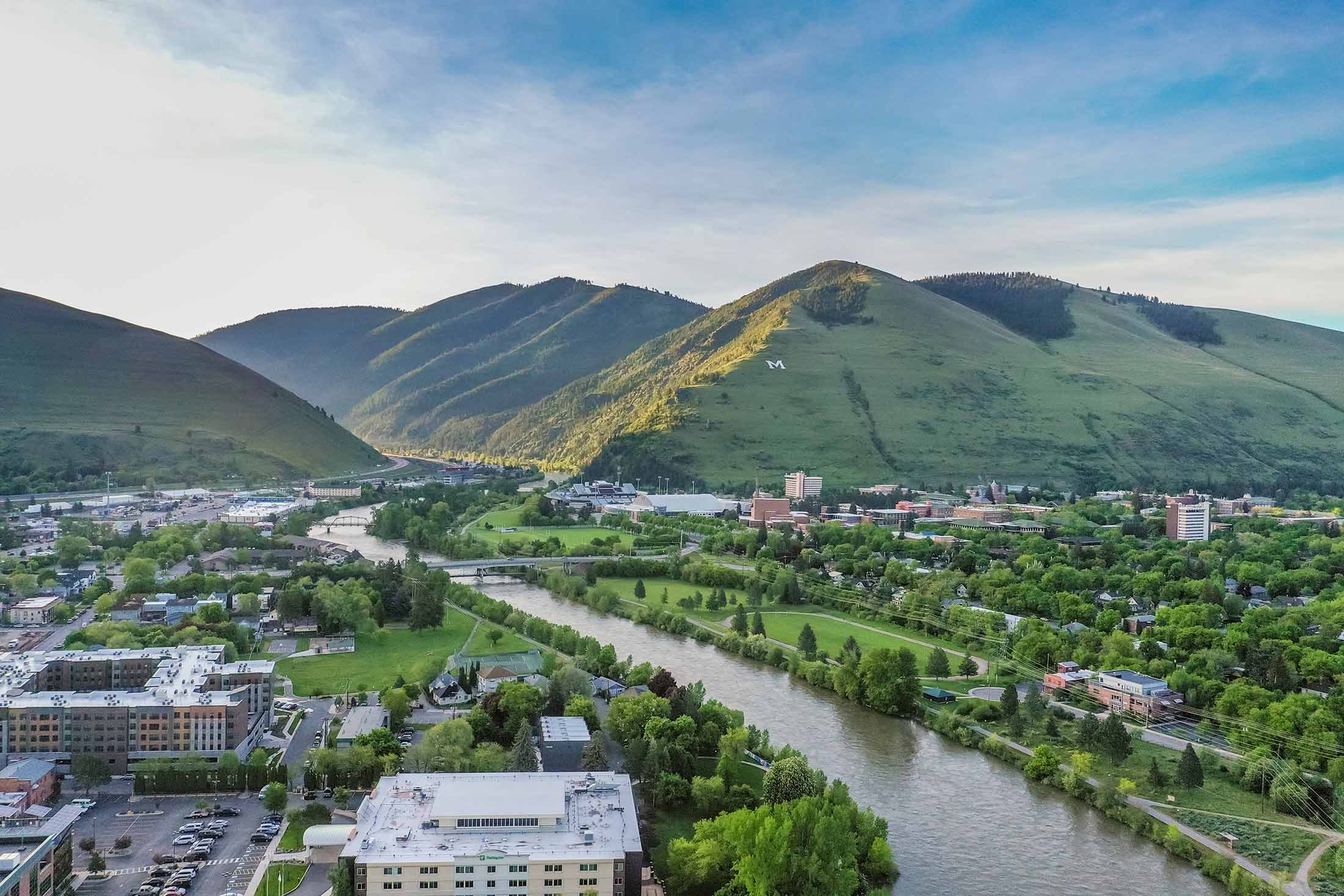
Rising directly above the University of Montana, Mount Sentinel is one of Missoula’s most recognizable landmarks. The mountain has been closely tied to the University since the early 1900s, when forestry students built the first trail to the iconic hillside “M” and carried stones up the slope to create the symbol that still overlooks the city today. Standing at 5,158 feet, Mount Sentinel offers an extensive network of trails that connect hikers, runners and mountain bikers to Missoula’s open space system.
Trail Tip: Parking for The “M” Trail and Mount Sentinel summit via Hellgate Ridgeline requires payment during weekday university operating hours, while weekend parking is free. Spaces are limited, so plan to arrive early and be sure to check current parking regulations and enforcement times before your visit.
The “M” Trail is one of Montana’s most iconic hikes. Featuring 13 switchbacks, this short but steep route offers a rewarding climb with sweeping views of the Missoula Valley. Beginning at the base of Mount Sentinel, the trail is easily accessed from the Campus Drive trailhead. Open year-round, it’s a favorite among locals seeking a quick workout or scenic outing. Along the way, several benches provide ideal spots to rest and take in the views.
Length: 1.8 miles round trip
Elevation: 646 ft. elevation gain
Time: 1-1.5 hours
Difficulty: Moderate


Not for the faint of heart, this challenging climb rewards hikers with panoramic views of the city, the Clark Fork River and surrounding mountain ranges. Beginning at the Campus Drive Trailhead, the route gains elevation quickly, with rugged rock features adding to the adventure. A favorite among locals seeking a solid workout, this well-loved trail also connects to several other routes for those looking to explore more of the area. Open year-round, the trail offers little shade, so be prepared for warm conditions from spring through fall.
Length: 3.8 miles round trip
Elevation: 1,916 ft. elevation gain
Time: 3-4 hours
Difficulty: Hard
The Pengelly Ridge Trail can be accessed from the Maurice Avenue trailhead near the University of Montana Golf Course. The route begins with a gradual climb before transitioning to steeper pitches as you gain elevation. Continue to the summit for expansive views of the valley below and glimpses of Lolo Peak on the horizon.
Note: Dogs must be kept on-leash in all parking areas, within 200 yards of trailheads on City Conservation Lands and in any posted on-leash zones; beyond those areas, dogs may be off-leash if they remain under voice control.
Length: 6.1 miles round trip
Elevation: 2,208 ft. elevation gain
Time: 4-4.5 hours
Difficulty: Hard
Situated in the heart of five mountain valleys and at the confluence of three rivers, Missoula, Montana, is a haven for outdoor recreation and nature enthusiasts, as well as an important habitat and migration corridor for many animal species critical to the intermountain west’s vibrant wilderness. Whether you are just passing through or if you call Missoula home, here are some ways you can do your part to keep Missoula beautiful from peak to paddle.